Holiday Storm Watch: Millions at Risk as Tropical System Brews Near Florida
Forecasters are sounding the alarm as a developing weather disturbance near Florida threatens to upend Fourth of July plans for millions across the Southeast.
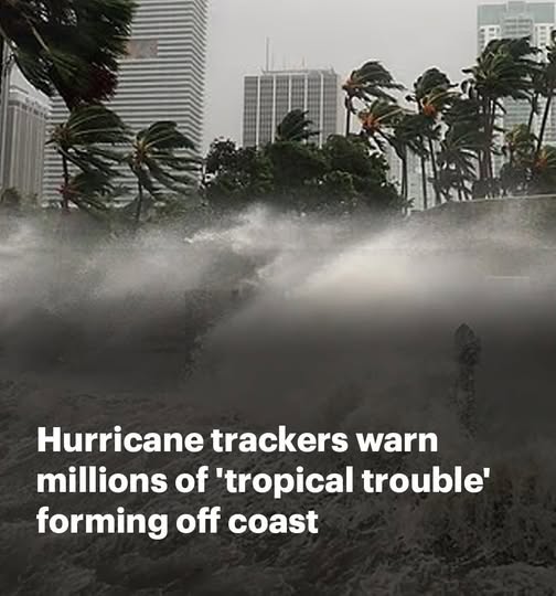
The National Hurricane Center (NHC) is closely monitoring a large system stretching from the northeastern Gulf of Mexico across the Florida Peninsula and into the Atlantic, warning it could evolve into a tropical or subtropical storm by week’s end. While the odds of formation currently sit at 20%, experts say the threat of heavy rain, dangerous surf, and rip currents remains very real — even if the system never earns a name.
Holiday Travel in Jeopardy
This looming weather threat comes as a record-breaking 72.2 million Americans are expected to travel for Independence Day, thanks to the holiday falling on a Friday and creating a long weekend.
States most at risk include Florida, Georgia, Alabama, Mississippi, and the Carolinas — home to more than 39 million residents — with coastal areas such as Tampa Bay, Apalachee Bay, and Florida’s Big Bend region especially vulnerable.
“More tropical trouble possible in the Gulf this week,” warned Meteorologist Zack Shields. “This system isn’t expected to impact Texas, but it’s heading for Florida.”
Midweek Storm Surge
Meteorologists say rough weather could begin by midweek, with the heaviest rain arriving Thursday, July 3 — just as millions hit the road and skies. Some areas may receive several inches of rain, with strong thunderstorms forecast from the Deep South to the Northeast.
Cities like Atlanta, Tallahassee, Washington, DC, Philadelphia, and New York could see travel disruptions including airport delays and cancellations, particularly along the I-95 corridor.
Still Early — But Not to Be Ignored
Though still in its early stages and classified as a tropical cyclone — a rotating system of thunderstorms over warm waters — the disturbance is being watched closely. If wind speeds increase to 39 mph, it would become a named tropical storm, and would be called Chantal.
Meteorologist Jennifer Gray warned, “Many Fourth of July barbecues, beach trips, and outdoor activities in the region may need a plan B. Heavy rain looks likely heading into the holiday weekend.”
Currently, there are no tropical storm watches or warnings in effect, and Florida’s Division of Emergency Management has stated the system poses no immediate threat over the next 5–7 days. Still, forecasters emphasize the importance of staying alert.
“If a system is near land and has the potential to develop, we won’t wait to issue advisories,” said NHC Deputy Director Jamie Rhome. “This helps residents prepare.”
The Bigger Picture
The 2025 Atlantic hurricane season began on June 1 and runs through November 30. NOAA and the NHC continue to monitor conditions using satellites and color-coded maps, placing this system in the “yellow zone” — meaning low risk for now, but not to be dismissed.
With millions on the move, authorities urge everyone in the Southeast and along the East Coast to monitor weather alerts, secure travel plans, and be ready to adjust.
“It’s not a named storm — yet. But it doesn’t have to be to cause serious disruptions,” forecasters caution.