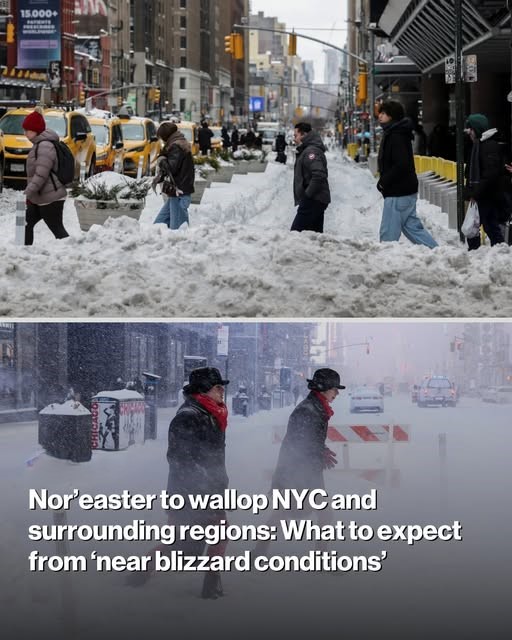
New Yorkers had better brace themselves for another blizzard, with 18 inches of snow forecast to sock the area.
Just as the messy mounds on street corners were finally melting and cars were all dug out, a new, massive storm system sparked a blizzard warning for Sunday and Monday, with snow expected to fall at more than 1.5 inches per hour.
“We are describing this storm as a major nor’easter,” AccuWeather senior meteorologist Carl Erickson told The Post early Saturday.

“With very strong winds, near blizzard conditions, and treacherous travel conditions. And those travel conditions are going to worsen rapidly Sunday night into Monday morning.”
The blizzard warning for NYC, Long Island and New Jersey takes effect at 6 a.m. Sunday and lasts until 6 p.m. Monday.
It prompted forecasters to post images of imposing weather maps which swathed the area in purple to indicate the strength of the storm.
Blizzard warnings are only issued when 13 to 18 inches of snow is expected and winds of 55 mph are predicted.
The five boroughs and New Jersey are expected to get anywhere from 13 to 17 inches.
Conditions could be much worse on Long Island and coastal Connecticut — which could see a foot or more, while Suffolk County is expected to face a staggering 18 inches of snow.
From Sunday afternoon through Monday morning, the tri-state will not only face heavy snow, but strong winds of up to 50 mph in the five boroughs and up to 60 mph across Long Island.

“There could be some localized power outages with the wind gusts,” Erickson warned.
Light snow will start as early as 6:00 a.m. Sunday morning, when temperatures are above the freezing mark, but precipitation will get heavier by the afternoon.
“It will be difficult to get a lot in the way of accumulation during the daytime hours on Sunday, just given temperatures above freezing,” he said.

“The worst of this storm will be overnight Sunday and into Monday morning. That’s when we expect the core of this nor’easter.”
Snowfall rates will start getting higher around 5 p.m. and will be at their highest Sunday night into Monday morning, from midnight to 8 a.m.
The heaviest snowfall will be from 10 p.m. Sunday through 10 a.m. Monday.
“You could be talking about 1 inch per hour or higher during that time,” he said.
Snow remains heavy until mid Monday morning, but will lessen around noon, and will finally end by late afternoon.
“The heaviest of snow will begin to taper off as we had past daybreak Monday,” he said.
“But there will still be some snow flying around into Monday afternoon.”
Temperatures will be in the mid 30s tomorrow, with Monday a little warmer, in the upper 30s.
“There’s not going to be a an extreme shot of cold air with this storm, which is why it will be difficult to get the snow to accumulate during the day tomorrow,” he said.
On Tuesday, temperatures will be in the mid 30s, and on Wednesday and Thursday, back into the lower 40s.
“So it will a slow, gradual melt of the snow throughout much of next week,” he said.
The last official NYC blizzard, dubbed “Snowzilla,” was January 2016, when the city was hit with over two feet of snow.